

Pozyx GeoTIFF-viewer
Visualiseer en valideer je GeoTIFF-bestanden rechtstreeks in de browser.
Met deze gratis online GeoTIFF-viewer controleer je snel hoe je kaart of plattegrond uitlijnt op een wereldkaart, zonder GIS-software.
Waarom we deze tool hebben gebouwd
Bij Pozyx werken we elke dag met digitale plattegronden, uiterst nauwkeurige kaarten en gegeorefereerde beelden om real-time location systems (RTLS) en oplossingen voor asset tracking mogelijk te maken.
Toen we op zoek gingen naar eenvoudige tools om GeoTIFF's online te bekijken en te valideren, vonden we niets dat werkte zoals wij wilden. De meeste beschikbare viewers waren beperkt, onnauwkeurig of ondersteunden geen rotatie en correcte schaalverdeling. Andere opties zoals QGIS zijn krachtig, maar vereisen een volledige installatie en wat configuratie voordat je een GeoTIFF goed op een wereldkaart kunt weergeven. Zelfs dan merkten we dat de beeldkwaliteit of coördinatennauwkeurigheid soms niet ideaal was voor snelle validatie.
We hebben deze lichte, webgebaseerde tool gebouwd om een GeoTIFF snel en eenvoudig correct gepositioneerd op een kaart te bekijken. Voor zeer grote bestanden of professionele geospatiale verwerking raden we nog steeds QGIS of vergelijkbare GIS-tools aan, maar voor snelle controles biedt deze viewer een direct en nauwkeurig alternatief.
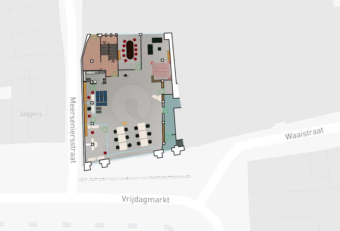
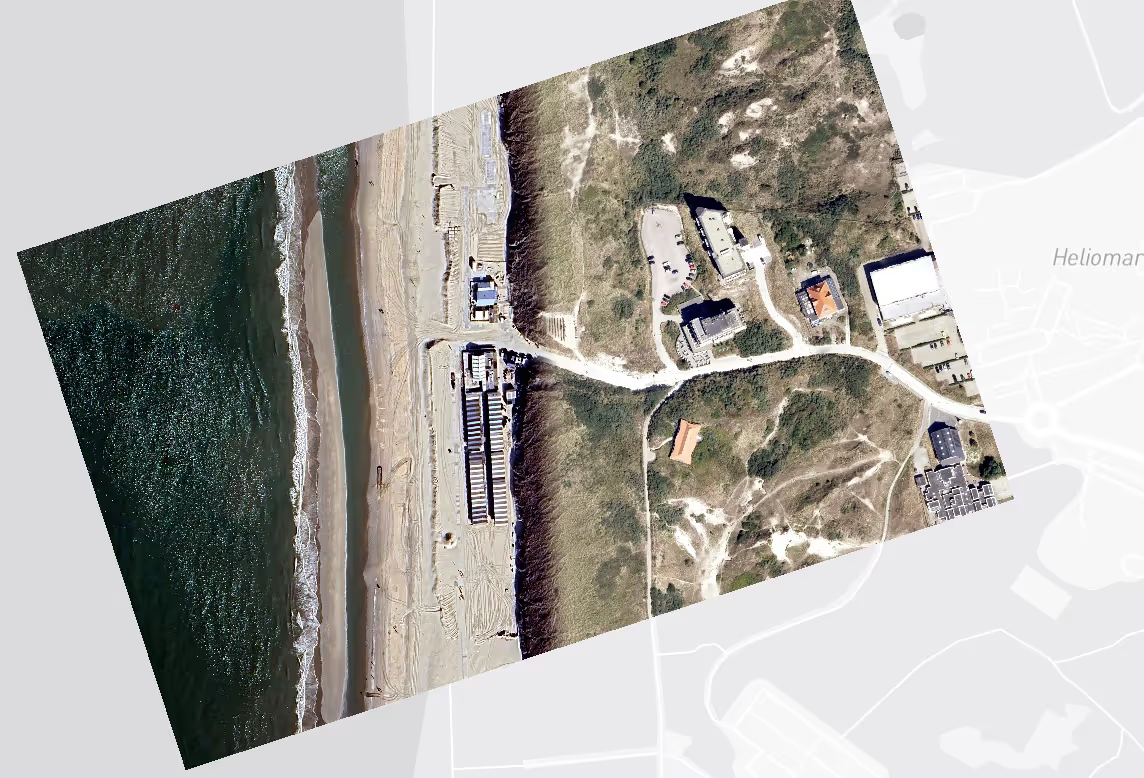
Voorbeeld-GeoTIFF's om te testen
Wat deze viewer ondersteunt
- Standaard GeoTIFF-bestanden (RGB- of RGBA-rastergegevens)
- Ingebedde coördinatenreferentiesystemen (CRS), inclusief EPSG:4326, EPSG:3857 en UTM-projecties
- 16-bits en 8-bits beelden, met automatische kleuruitrekking voor visualisatie
- Rotatie en affine transformaties, met GeoTransform- of ModelTransformation-metadata
- NoData-transparantie en instelbare dekking
- Grote bestanden, automatisch verkleind voor browserweergave; houd er rekening mee dat het lang kan duren om te laden.
Wat het niet ondersteunt
- Cloud Optimized GeoTIFF-streaming (COG) (alleen lokale bestandsupload)
- Wetenschappelijke rasters met meer dan vier banden
- Geavanceerde rendering of symbologie (zoals aangeboden door desktop-GIS-software)
Deze beperkingen houden de viewer licht en snel voor praktische toepassingen, zoals het valideren van plattegronden, luchtbeelden of satellietlagen voordat je ze importeert in het Pozyx Platform.
Hoe dit aansluit op het Pozyx Platform
Dezelfde technologie die hier wordt gebruikt, vormt de basis van de Pozyx Mapping Service, waarmee gebruikers:
- Upload en georeferentieer beeldplattegronden of luchtfoto's in hoge resolutie van industriële locaties, magazijnen of bouwterreinen voor gebruik in asset- en voertuigtracking
- Upload GeoTIFF's rechtstreeks om gedetailleerde kaartbeelden uit te lijnen met coördinaten uit de echte wereld
- Visualiseer binnen- en buitenkaarten samen in één uniform coördinatensysteem
- Beheer plattegronden met meerdere verdiepingen en 3D-plattegronden voor complexe omgevingen
- Leg real-time locatiegegevens over van UWB-, BLE- of GPS-trackers
- Definieer zones, geofences en interessegebieden ter ondersteuning van locatiebewuste workflows

Deze viewer laat de kern zien van Pozyx’ verwerking van geospatiale data, waarbij kaarten, locatiebepaling en context samenkomen om nauwkeurig inzicht te bieden op elk niveau van je operatie.
Over Pozyx
Pozyx levert real-time location systems van enterprise-niveau voor Industrie 4.0.
Het Pozyx Platform maakt nauwkeurige indoor- en outdoor-tracking van assets en voertuigen, zonebewaking en procesoptimalisatie mogelijk. Pozyx ondersteunt UWB-, BLE- en GPS-positioneringstechnologieën en integreert naadloos met Omlox, MQTT en grote IoT-platformen.