Map Integration & visualization
See Your Operations
in Full Context
The Pozyx Platform brings together multiple map sources, including indoor floorplans, outdoor maps, satellite imagery, and custom orthomosaics, into a single intuitive spatial interface. It enriches these map layers with precise location data, providing a clear and accurate view of what is happening across your facilities.
Unified Indoor and Outdoor Maps
Understand Spaces, Not Just Coordinates
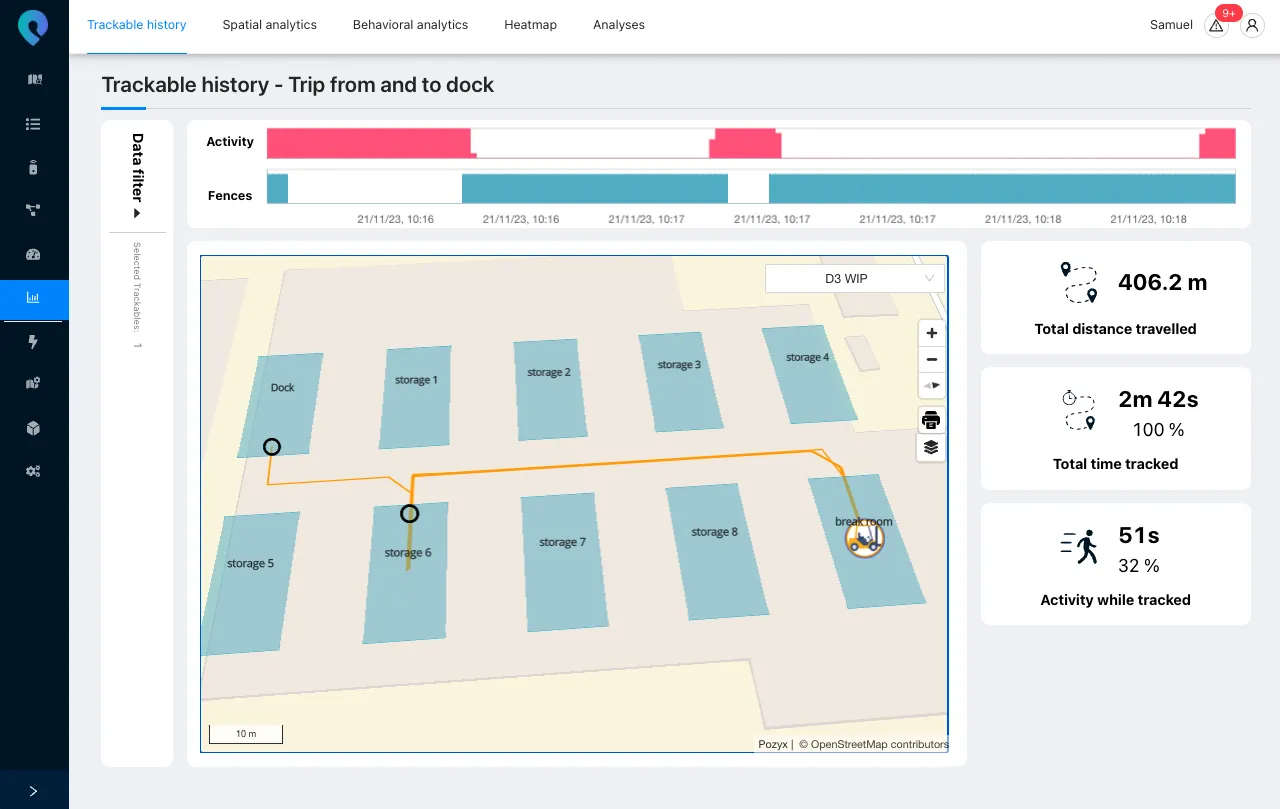
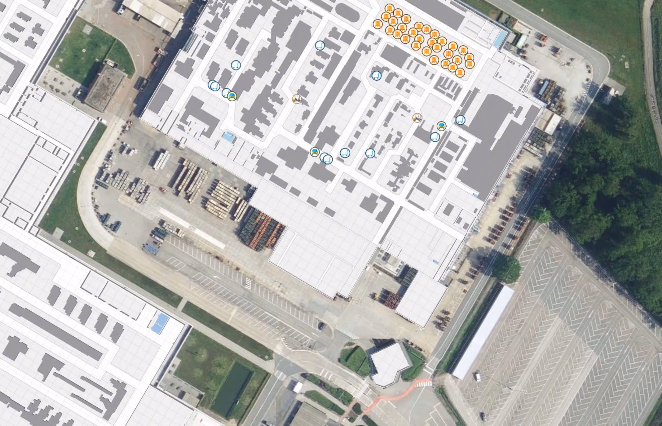
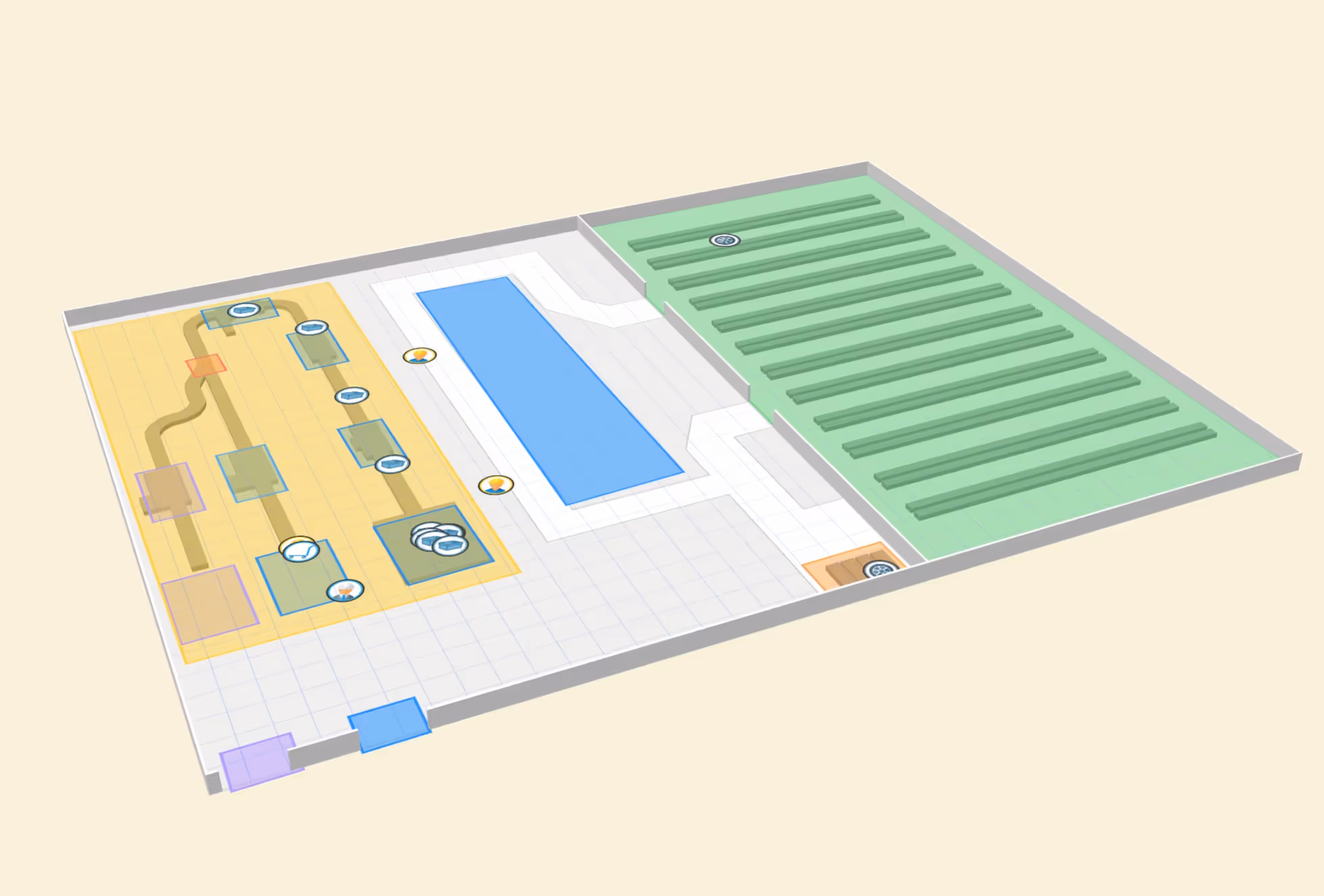
Track assets and people across buildings, yards, and campuses. Switch effortlessly between floors, zoom into operational hotspots, or explore a site layout in 2D or 3D. The platform turns raw coordinates into meaningful identifiers, showing exactly which building, floor, room, or outdoor address an asset is located in.

Bring Your Reality Into the Platform
Start from what you already have: CAD drawings, floorplans, scans from indoor capture systems, or high-resolution drone orthomosaics. Pozyx turns these assets into spatial layers you can interact with, visualize, and keep up-to-date as your site evolves.
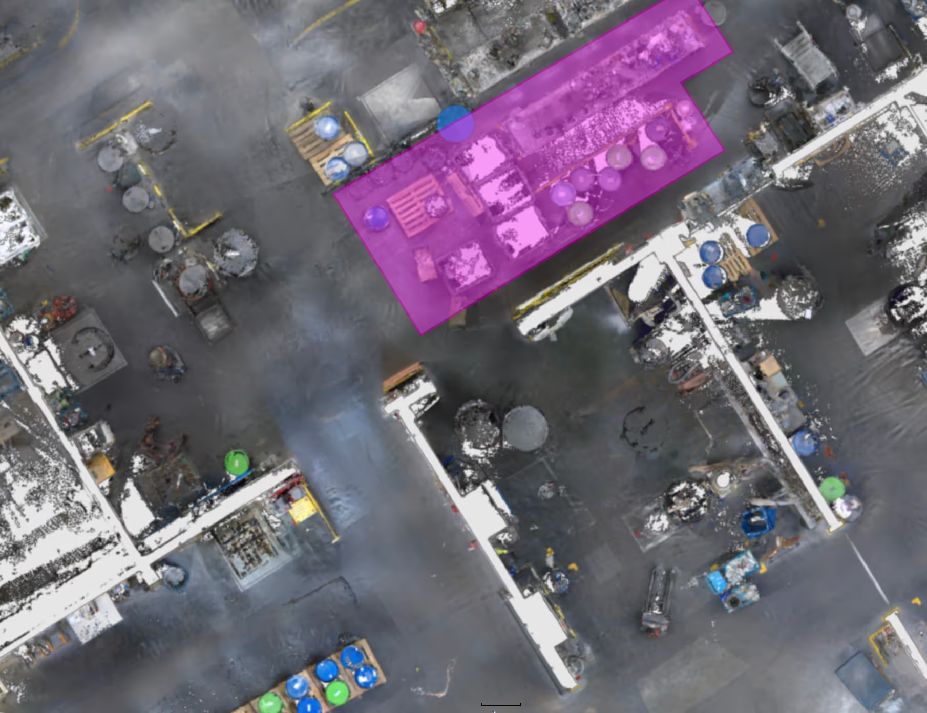
Draw Boundaries With Confidence
Accurate imagery makes it easy to define geofences, zones and safety perimeters exactly where they matter. Whether you manage a warehouse layout, a logistics yard, or a construction site, geofences can follow real walls, doors, lanes, and equipment — not approximations.
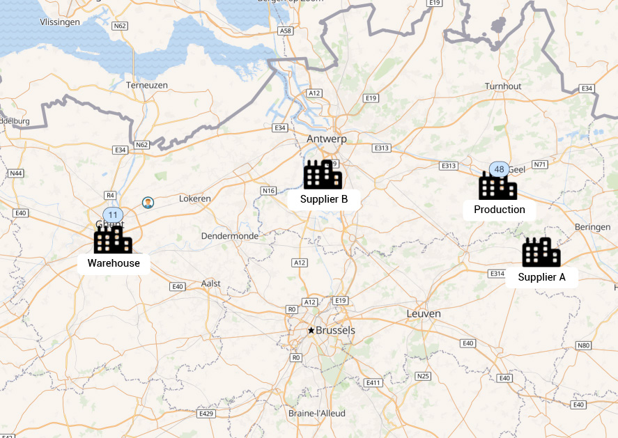
Manage Multiple Sites with Ease
View and operate multiple locations from a single interface, whether they are buildings in the same campus or facilities spread across regions. Instantly see which assets belong to which site, compare activity levels, and switch context without losing track of people, equipment, or workflows. This central view simplifies supervision, reduces navigation overhead, and supports scalable deployments as your operations grow.
Designed to Fit Your Technology Stack
Mapping layers are exposed through standard tile server APIs, allowing vector tiles for digital floorplans and raster tiles for custom imagery of sites or building floors. Use the Pozyx viewer or build your own application, and the data remains open and interoperable.

Professional Mapping
Services
Transforming site data into operational spatial layers can be complex. Pozyx offers expert services directly or through its partners to ensure your environment is accurately represented and ready for location-aware applications.

What we can do for you
- Digital Map Creation
We turn CAD drawings, PDFs, or image files into structured digital (IMDF) maps with buildings, floors, rooms, and fixtures ready for indoor visualization and geofencing. - Drone Capture & Orthomosaic Production
We can organize drone flights and generate high-resolution GeoTIFF imagery with true vertical alignment for outdoor yards, construction sites, and multi-building campuses. - Image Sanitization & Asset Redaction
Remove sensitive, temporary, or proprietary objects from imagery to create clean, sharable maps suitable for safety audits, partner collaboration, or compliance reporting.
in action