Pozyx Platform v3.1: Smarter Tracking, Stronger Insights, Greater Flexibility

With the release of Pozyx Platform v3.1, we’re taking another step toward making asset tracking simpler, more powerful, and more accessible, whether you're operating indoors, outdoors, or somewhere in between.
This update focuses on unlocking more value from your data, expanding tracking capabilities, and refining the experience across the platform.
BLE Asset Tracking with Scanning (New)
One of the biggest additions in v3.1 is BLE asset tracking with scanning.
GPS trackers can now detect nearby BLE tags, opening up a cost-effective and flexible way to track tools and assets without requiring a full infrastructure setup.
What this enables:
- Track tools on the road using a truck equipped with a BLE scanner
- Presence detection in warehouses or facilities
- Asset visibility in low-infrastructure environments
In many cases, a single wireless, battery-powered BLE scanner is enough to get started, making this a highly scalable solution for distributed operations.
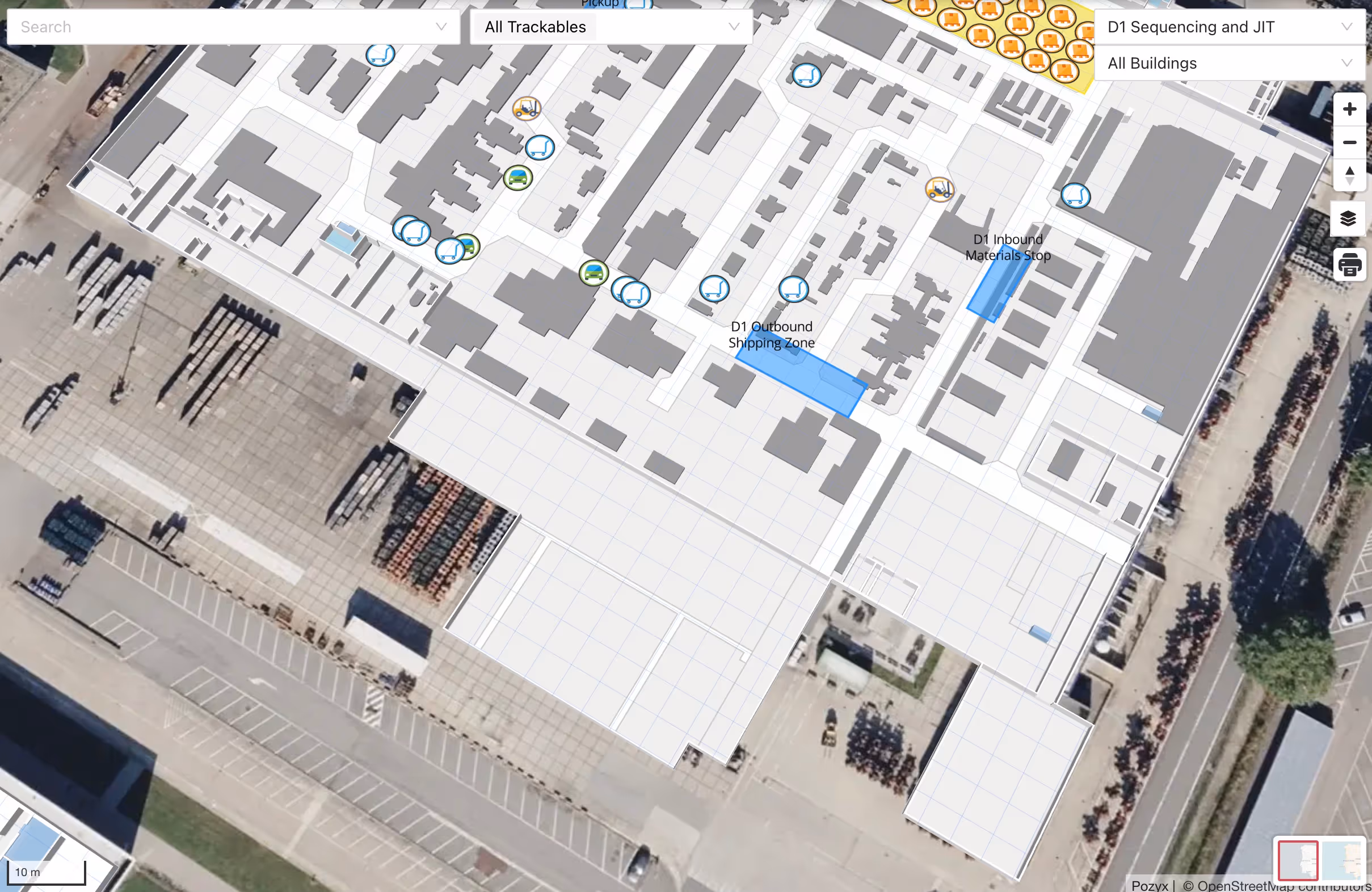
A More Powerful Map Experience
We’ve completely reworked the map overview to give you more context, faster.
Instead of just showing locations, the map now highlights what actually matters for your day-to-day operations:
- Trackables that require attention
- Geofence details
- Active trips or jobs
- Historical movement
While the underlying data has not changed, the way it is presented has. The result is a more actionable, intuitive, and impactful interface that helps teams make decisions faster.
Stronger GPS Tracking for Outdoor Operations
Platform v3.1 reinforces our support for GPS-based asset and inventory tracking in outdoor and remote environments.
Perfect for:
- Yards and industrial sites
- Remote or temporary locations
- Outdoor storage and logistics hubs
Key improvements:
- Enhanced compatibility with Digital Matter GPS trackers
- More reliable data handling and smoother onboarding
- Satellite basemap for better outdoor visibility
- Address search and readable locations instead of raw coordinates
For environments where satellite imagery falls short, you can now also integrate drone or aerial imagery, which is ideal for:
- Construction sites
- Shipping yards
- Large industrial facilities
More information on the new map capabilities here.
Small but Mighty Improvements 💪
We’ve also made a series of targeted upgrades across the platform:
- Enhanced process visibility dashboard, including time-in-step insights
- Ongoing improvements to the public API
- More accurate dwell time detection for GPS and UWB
- Performance improvements for trips and jobs
- General bug fixes and stability improvements
Built for Real-World Operations
With v3.1, Pozyx continues to bridge the gap between indoor and outdoor tracking while making powerful capabilities easier to deploy and use.
Whether you're tracking tools on the move, monitoring assets in remote locations, or optimizing workflows on-site, this release gives you more flexibility, better visibility, and faster insights.
Written by
Samuel Van de Velde

CTO & Co-Founder at Pozyx
Samuel is an electrical engineer with a strong interest in location technology. Skilled in Entrepreneurship, Public Speaking, Product Management, internet of things (IoT), and Machine Learning. After graduating In 2010, he joined the Department of Telecommunications and Digital Information Processing (TELIN) to pursue a Ph.D. degree on the topic of collaborative indoor localisation. In 2015, he founded the spin-off company Pozyx out of that research.